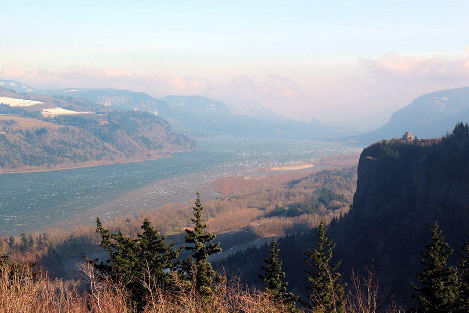
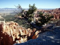
Looking towards Crown Point from Portland Women’s Forum State Scenic Viewpoint, at Chanticleer Point
Work on the Historic Columbia River Highway started in 1913 and as the first scenic highway built in the U.S. it is now a National Historic Landmark. The road’s engineer, Samuel C. Lancaster put great care not to “mar what God had put there” and did a great job. The road winds gently through the Columbia River Gorge, linking the numerous beauty spots on the route whilst barely being noticeable.
The Gorge is 80 miles long and cuts up to 4,000 feet deep through the Cascade Mountain Range. It’s place in American history was cemented when Lewis and Clark’s Corps of Discovery made their way through the Gorge, following the Columbia river to the Pacific Ocean. Later Oregon Trail Pioneers followed the same route in the mid-1800s.
Finding the Historic Columbia River Highway
From Portland, take Interstate 84 east to exit 17 for Troutdale. Brown signs will lead you over the Sandy River and onto the Historic Columbia River Highway.
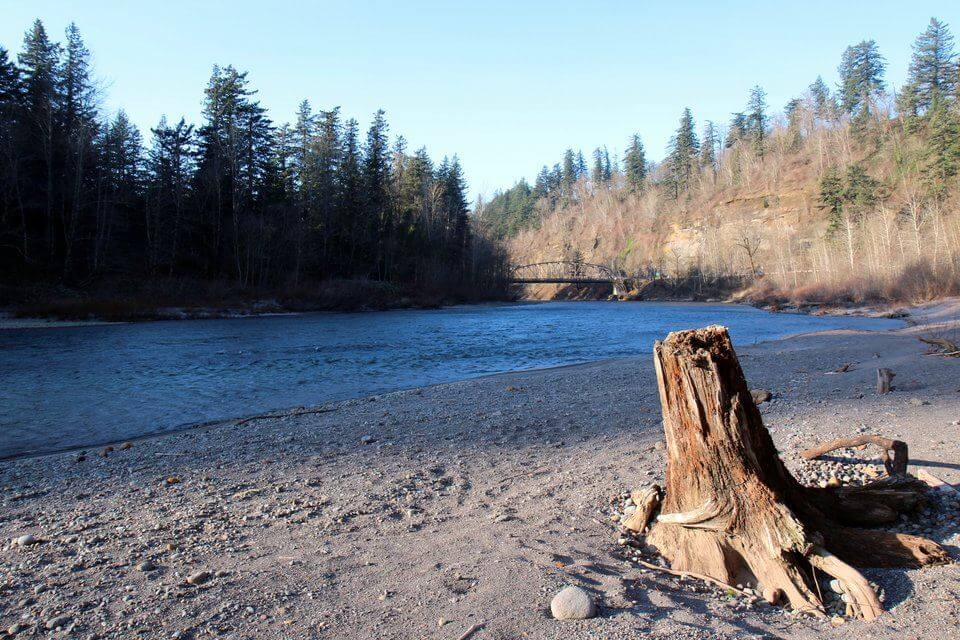
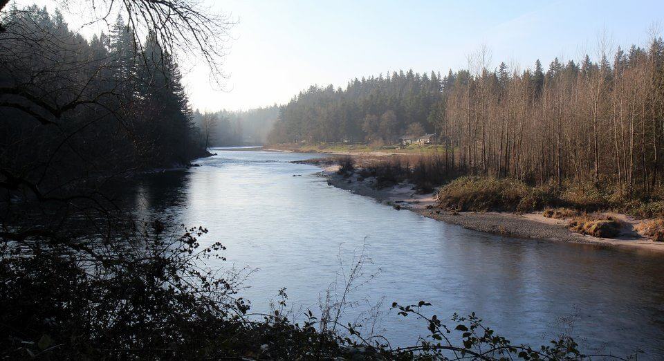
Sandy River
Sandy River
Starting in the glaciers high on the slopes of Mount Hood, the Sandy River drops nearly 6,000 feet in 55 miles until it meets with the Columbia River near Troutdale. After its rapid decent though meadows, forests and gorges the river here is calm and used for boating, fishing, wading and swimming
In 1988, Congress made Sandy River part of the National Wild and Scenic Rivers System. Oregonians are understandably proud that nearly one-third of the nation’s Wild and Scenic Rivers are in Oregon.
Sandy River, next to the start of the Historic Columbia River Highway
Chanticleer Point
The ‘Portland Women’s Forum State Scenic Viewpoint’ at Chanticleer Point boasts one of the ‘most magnificent views in the world’.
The structure on the hill opposite is Vista House, atop the 733-feet sheer cliff of Crown Point. It serves as an observatory and memorial to Oregon’s Pioneers.
Samuel Lancaster, the Highway’s chief engineer, knew that it was the ideal site for “an observatory from which the view both up and down the Columbia could be viewed in silent communion with the infinite.”
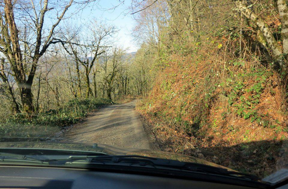
I’d love to have driven over to Crown Point, but the high winds had blown down trees and damaged power lines, so the main road was closed to traffic whilst repairs were made. At this point we decided to make full use of our rented 4×4 and its fully comprehensive insurance…
Not Vista Point
Detour
I have no idea where we were, as there was no data connection to power the GPS. We were generally heading upwards, hoping to get to Crown Point, but all roads eventually led downhill to the river, taking us inevitably towards Multnomah Falls.


Pingback: Steve Juba (@solotravelclubs)
Pingback: Carol M Biederman (@lgdealstoday)
Pingback: Lisa Niver Rajna (@wesaidgotravel)
Pingback: The Traveling Fool (@thetravelfool)
Pingback: @TheCityLane
Pingback: @YapaNow
Pingback: Natalie Sayin (@turkishtravel)